
Route guess
Sketch the route you remember running before you see the GPS, then compare what you intended with what you did.
After you add a run, Analyse can show you the map with the course on it and nothing else, and ask you to draw the route you believe you took. You see the GPS only afterwards. The step is off by default, so adding a track goes straight to the analysis.
What it is for
Turn it on
In your profile, on the Events & import tab, switch on Draw your route from memory. While it is off, the upload says that sketching from memory is off and moves on. It is also skipped on its own when the event has no map, or no controls for your class. See Settings.
Draw your route
Step 1. Add your run as usual
Step 2. Choose how you draw
Step 3. Draw leg by leg, or the whole route
Step 4. Finish
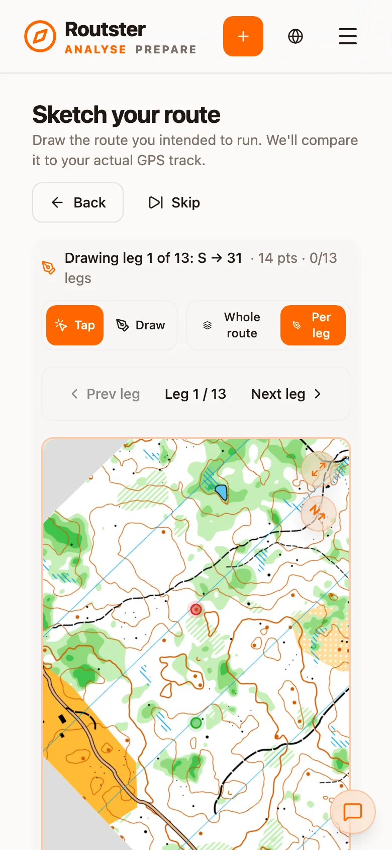
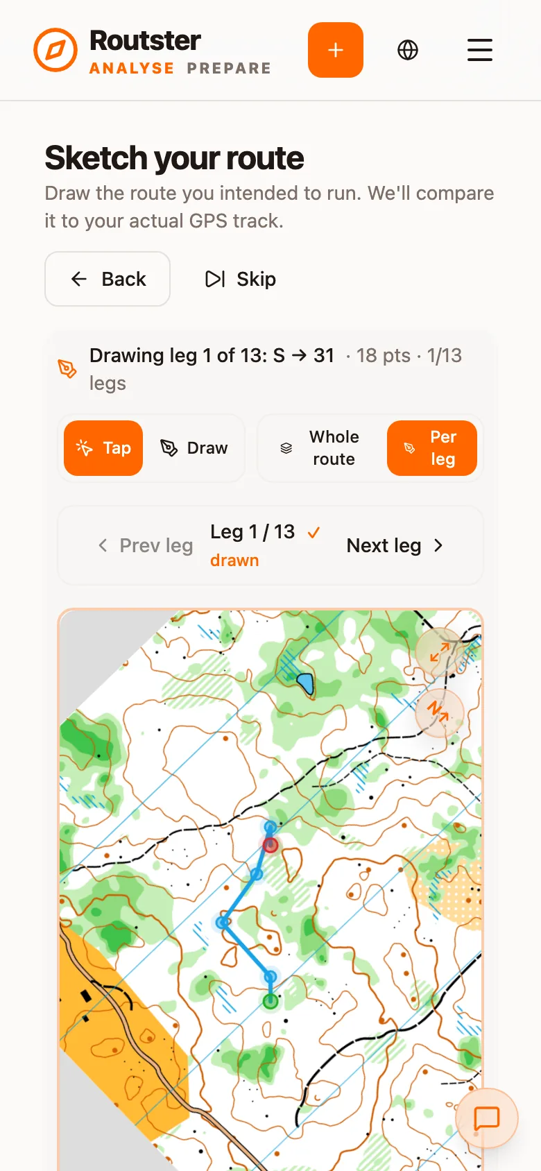
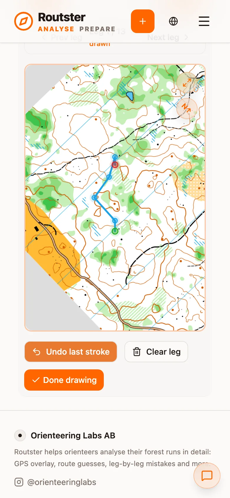
Draw it as you remember it. The comparison is only meaningful against an honest sketch.
What it unlocks
The deviation chart
With a sketch saved, the analysis gets a section called Guess vs Actual Deviation. It plots the perpendicular distance between your GPS position and the line you drew over the length of the leg. The shape of the curve separates three things:
- A slow, steady climb away from zero is compass drift: a bearing a few degrees off.
- A sudden step is a decision: leaving the line, whether or not you noticed.
- A spike that returns to zero is a relocation.
Spans where the deviation exceeds 30 metres are listed as off-route spans, each with a button that takes the map to it.
The overlay
The sketch is drawn alongside the track in full course and per-leg, in its own colour (Guess color in the settings), weight and dash style. It is dashed by default, so it does not read as a second GPS track. Switch it on or off with Show your guess by default in Settings, or in the map settings of one analysis.
Off-route spans are not counted as mistakes
Deviation from your sketch is reported in the deviation chart and its span list. It is not added to the mistake count. A sketch is a memory rather than a measurement, so a discrepancy between it and the GPS is not evidence of a navigation error. Mistakes are detected from the track itself; see Mistakes, performance and terrain.
Who sees your guess
Sprint: draw it, then compare it to the optimum
In a sprint the shortest legal path for each leg can be computed from the map's passability. Sketching the route you intended and then revealing both the optimum and the actual track separates running what you planned from planning the fast route. See Sprint analysis.